EKSU Professor Pushes Geoformatics as Strategic Tool for National Development
A Professor of Geoformatics at Ekiti State University (EKSU), Ado-Ekiti, Johnson Olatunji, has urged government and industry stakeholders to adopt geospatial intelligence as a core instrument for driving economic planning, environmental management, and national security.
A Professor of Geoformatics at Ekiti State University (EKSU), Ado-Ekiti, Johnson Olatunji, has urged government and industry stakeholders to adopt geospatial intelligence as a core ins trument for driving economic planning, environmental management, and national security.
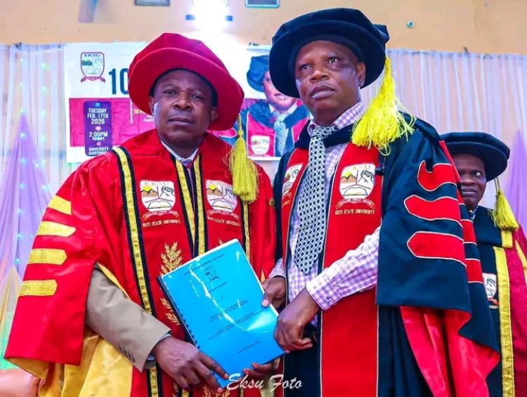
He made the call during the university’s 100th Inaugural Lecture titled “A Space to Explore, a Place to Protect, and a Race to Salvage: Geoformatics and National Development,” where he emphasized the expanding role of space-based technologies in modern governance.
Olatunji described geoformatics as a critical enabler of data-driven decision-making across multiple sectors, noting that it is no longer an emerging tool but an established requirement for sustainable national development. According to him, “Life is a space to explore and a place to protect.”
He explained that advanced economies have fully integrated geospatial technologies into planning systems, achieving measurable improvements in efficiency, resource management, and disaster response. He added that Nigeria must accelerate adoption to avoid widening developmental gaps.
The scholar identified at least seventeen application areas of geoformatics, including food security, urban planning, environmental monitoring, disaster management, governance systems, and national security operations. He stressed that the technology is particularly valuable for addressing Nigeria’s environmental and infrastructural challenges, based on decades of research and field experience.
Olatunji further noted that geospatial systems and Geographic Information Systems (GIS) have become foundational tools in global development architecture, enabling governments to visualize, analyze, and predict spatial patterns for better policy outcomes.
In his remarks, the Vice-Chancellor of EKSU, Professor Joseph Babatola Ayodele, described the lecture as highly impactful and reflective of the university’s commitment to research-driven innovation. He noted that it was one of several inaugural lectures he has presided over within a short period, underscoring the institution’s active academic culture.
Ayodele emphasized that no modern development system can function effectively without integrating geoformatics into planning and decision-making processes. He also observed that the lecture expanded traditional perceptions of geography beyond physical landforms into a dynamic, technology-driven discipline.
The event was attended by government representatives, traditional rulers, university administrators, academics, and students, reflecting the growing relevance of geospatial studies in contemporary development discourse.